Bangkok Lumpini Benjakitti Park: New Green Corridor Connects Two Largest Parks
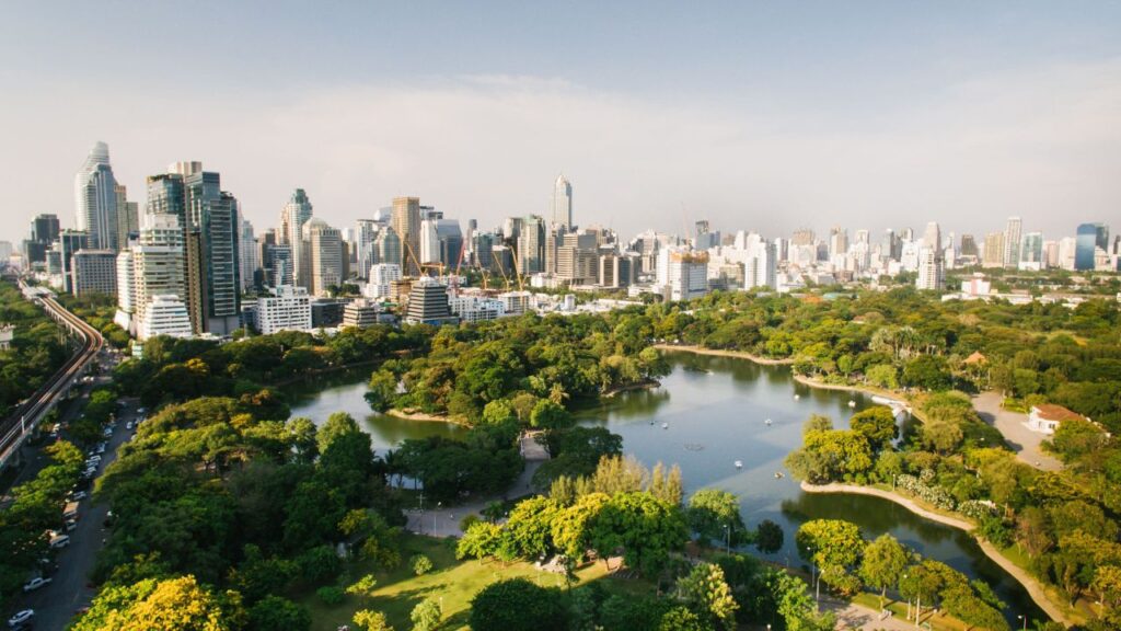
Bangkok Lumpini Benjakitti park Green Connection — a 1.6-kilometre elevated walkway with misting systems, vertical gardens and smart infrastructure linking Bangkok's two largest green spaces.
Bangkok Lumpini Benjakitti park connection is now under construction — a 1.6-kilometre elevated and ground-level walkway called the Green Connection that will bridge two of Bangkok’s largest urban green spaces for the first time in the city’s history. The corridor transforms an unremarkable, congested stretch of Witthayu Road into a continuous pedestrian and wellness pathway — and positions Bangkok as one of Asia’s most serious cities in treating green space as climate infrastructure rather than just decoration.
For Indian travelers visiting Bangkok, the Green Connection adds a significant new reason to explore the Sukhumvit–Silom corridor on foot — linking Lumpini Park to Benjakitti Forest Park in a continuous walkable experience unlike anything currently available in the city.
What the Green Connection Is and Why Bangkok Needs It
Until the Green Connection project began, the route between Bangkok Lumpini Benjakitti park areas was simply Witthayu Road — a congested, sun-exposed stretch that was genuinely hostile to pedestrians trying to walk between the two parks.
Bangkok had two significant green lungs sitting less than two kilometres apart with no meaningful way to connect them on foot. The Green Connection addresses this directly.
The 1.6-kilometre corridor is a linear elevated and ground-level walkway bridging the Witthayu central business district with the lakeside expanse of Benjakitti Forest Park — at 450 rai (approximately 72 hectares), the largest green space in inner Bangkok. Lumpini Park covers 360 rai and is fully renovated. Together, they now form Bangkok’s largest connected green zone accessible without a vehicle.
What Makes This More Than Just a Walkway
The Bangkok Lumpini Benjakitti park corridor is not simply a paved path between two parks. It is designed as climate-adaptive infrastructure — a living buffer that incorporates specific features addressing Bangkok’s three most pressing urban environmental challenges.
Misting systems are embedded throughout the corridor to combat Bangkok’s rising urban heat island effect. Landscape architect Kotchakorn Voraakhom of LANDPROCESS — who designed the Chong Nonsi Canal Park and Chulalongkorn Centenary Park — has publicly described Lumpini’s surrounding urban development as having made the park an unhealthy lung. The misting infrastructure directly addresses that heat compression problem.
Vertical gardens and pocket gardens are embedded along the corridor’s length, increasing the green biomass between the two parks and creating continuous cooling shade in a zone where the urban heat island is most concentrated.
Smart CCTV infrastructure and MINE Smart Ferry ports along the canal edge integrate the corridor into Bangkok’s broader Blue & Green Network — connecting pedestrian movement with water transport and digital urban management systems.
Sport-grade surfacing and high-performance accessibility ramps with universal design principles make the corridor usable by wheelchair users, elderly visitors, and anyone who might otherwise find Bangkok’s standard street infrastructure inaccessible.
| Bangkok Lumpini Benjakitti Park Corridor | Details |
|---|---|
| Project Name | Green Connection |
| Total Length | 1.6 kilometres |
| Type | Elevated and ground-level walkway |
| Parks Connected | Lumpini Park (360 rai) + Benjakitti Forest Park (450 rai) |
| Climate Features | Misting systems, vertical gardens, pocket gardens |
| Smart Infrastructure | CCTV network, MINE Smart Ferry ports |
| Accessibility | Universal design, sport-grade surfacing, accessibility ramps |
| Programme | Bangkok Metropolitan Administration Blue & Green Network |
Bangkok’s Sinking City Problem — Why Green Corridors Are Infrastructure
The Bangkok Lumpini Benjakitti park corridor exists within a much larger and more urgent urban context. Bangkok is built on soft alluvial soils from the Chao Phraya delta — and the city is sinking at approximately two centimetres per year.
The IPCC projects sea levels to rise by 33 centimetres by 2050. For a city already below sea level in large parts of its historical core, that combination of land subsidence and sea level rise is existential — not theoretical.
Landscape architect Kotchakorn Voraakhom has articulated this clearly in public forums: parks in Bangkok are not amenities, they are infrastructure. The Green Connection is the most visible application of that philosophy to a flagship public space. Permeable surfaces, water retention design, vertical plantings, and the canal-edge connectivity with Smart Ferry ports all contribute to the corridor’s role as a water management system — not just a pleasant walkway.
The Bangkok Metropolitan Administration’s Blue & Green Network is the broader framework within which this project sits. Earlier pilot projects including the Chong Nonsi Canal Park and the Chulalongkorn Centenary Park tested versions of this approach — and researchers from the Stockholm Environment Institute noted both successes and practical limitations that inform how the Green Connection is being designed.
What SEI Research Found About Bangkok’s Parks
The Stockholm Environment Institute conducted fieldwork at Bangkok’s pocket parks in early 2025 and found that park use varies dramatically by neighbourhood, design, and aesthetic — but that the parks drawing hundreds of visitors at peak times share one consistent quality: meaningful integration with their surrounding communities and public transit networks.
Parks that were designed primarily for visual appeal rather than daily use tended toward underutilisation even in high-density neighbourhoods. Parks embedded into commuter routes, near BTS or MRT stations, or connected to canal transport tended to attract sustained daily usage.
The Bangkok Lumpini Benjakitti park corridor applies these findings directly — connecting two parks via a walkway that also links to the BTS Skytrain network, canal ferry services, and the surrounding Sukhumvit and Silom business districts. The corridor is designed to attract office workers on morning and evening commutes, not just weekend leisure visitors.
BMA is also applying lessons from the Chong Nonsi Canal Park pilot. That project faced criticism after completion because smaller non-native tree species replaced large native ones, concrete coverage increased, and water quality improvements were slower than projected. The Green Connection appears to be addressing these specifically — prioritising function over form and water management over greenery aesthetics.
What This Means for Indian Visitors to Bangkok
For Indian travelers exploring Bangkok, the Bangkok Lumpini Benjakitti park Green Connection offers a genuinely new experience in one of the city’s most central and accessible areas.
Lumpini Park is already one of Bangkok’s most visited attractions for morning walkers, jogging enthusiasts, and those seeking green space in the heart of the city. Benjakitti Forest Park — with its lake, elevated boardwalk through forest canopy, and cycle tracks — has emerged as Bangkok’s most architecturally interesting public park and a favourite for photographers and wellness-oriented visitors.
Once the Green Connection is complete, Indian families, couples, and solo travelers staying anywhere in the Sukhumvit–Silom corridor can walk between both parks continuously — morning yoga at Lumpini, walk along the Green Connection, cycle or walk around Benjakitti’s lake, and return. It is a full-morning activity without needing a car, a Grab, or a BTS ticket.
Both parks are free to enter. The nearest BTS stations are Silom and Lumphini for Lumpini Park, and Sukhumvit (Asok) and Queen Sirikit National Convention Centre for Benjakitti. UPI does not work in Thailand — carry Thai Baht or use a zero-forex international card for any food or drink purchases at park-adjacent stalls.
For travel insurance covering your Bangkok trip, SafetyWing Nomad Insurance provides reliable coverage at affordable daily rates for Indian travelers.
FAQs — Bangkok Lumpini Benjakitti Park Green Connection
Q: What is the Green Connection and when will it open?
The Green Connection is a 1.6-kilometre elevated and ground-level walkway linking Lumpini Park and Benjakitti Forest Park in Bangkok — two of the city’s largest urban green spaces. The project is part of the Bangkok Metropolitan Administration’s Blue & Green Network. A confirmed opening date has not been published at the time of writing — the article confirms it is under construction as of July 2026. Lumpini Park’s own renovation was expected to be substantially complete by 2025.
Q: Why is the Bangkok Lumpini Benjakitti park project being built as climate infrastructure?
Bangkok is sinking at approximately two centimetres per year due to soft alluvial soils, and the IPCC projects sea levels to rise by 33 centimetres by 2050. The Green Connection is designed as climate-adaptive infrastructure rather than just a park amenity — incorporating misting systems for urban heat management, vertical gardens and pocket gardens for cooling, water retention surface design, and Smart Ferry port integration for canal transport connectivity.
Landscape architect Kotchakorn Voraakhom, who contributed to the Blue & Green Network, has described Bangkok’s parks as essential infrastructure rather than optional additions.
Q: How do Indian visitors get to Lumpini Park and Benjakitti Park?
Lumpini Park is accessible from BTS Silom Line stations — Silom Station and Lumphini Station are the nearest stops. Benjakitti Forest Park is accessible from BTS Sukhumvit Line Sukhumvit (Asok) Station and MRT Queen Sirikit National Convention Centre Station. Both parks are free to enter.
The Green Connection walkway, once complete, will allow visitors to walk continuously between the two parks through the Witthayu corridor without needing any transport.
Final Word
The Bangkok Lumpini Benjakitti park Green Connection is the most ambitious piece of connected green infrastructure Bangkok has built in its modern history — 1.6 kilometres of climate-adaptive walkway that treats urban green space not as a nice addition but as a necessary system response to sinking land, rising seas, and urban heat.
For Indian travelers, it adds a compelling new pedestrian experience to one of Bangkok’s most central corridors. For Bangkok’s residents and urban planners, it is a working prototype of the kind of city Bangkok must become to remain liveable through the climate pressures of the coming decades.
📌 Also Read:
- Bangkok Luxury Living 2026 — City Enters Global Top 10
- Thailand Travel Tips Indians 2026 — 9 Things to Sort Before You Fly
- SafetyWing Nomad Insurance — Full Review for Indians
🔗 Official Sources:
- The Nation Thailand — Bangkok Park Connector Between Lumpini and Benjakitti
- Bangkok Metropolitan Administration
 Riyadh Airport Reopens 2026: Flights Resume After 2-Week Houthi Attack Closure
Middle East Travel Warning 2026: Saudi Arabia Alerts From 10 Countries
Thailand Airport Baggage Rule 2026: Checked Bags Can Now Be Opened Without You

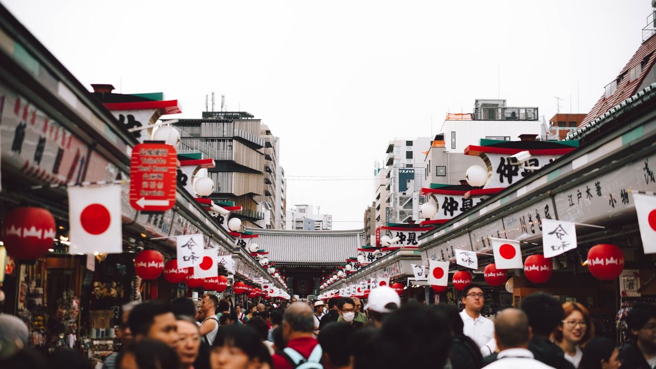
Japan Travel Rules 2026: Tax-Free Changes and Kyoto Luggage Ban Explained
Riyadh Airport Reopens 2026: Flights Resume After 2-Week Houthi Attack Closure
Middle East Travel Warning 2026: Saudi Arabia Alerts From 10 Countries
Thailand Airport Baggage Rule 2026: Checked Bags Can Now Be Opened Without You
Japan Travel Rules 2026: Tax-Free Changes and Kyoto Luggage Ban Explained

Aaseem Bhardwaj is a journalist, seasoned traveler and IT professional based in India. With firsthand travel experience across Southeast Asia, East Asia, Middle East and Europe, Aaseem founded Travel Man Today to provide reliable visa updates and travel news for Indian passport holders. He has personally traveled to Thailand, Vietnam, Malaysia, Japan, Singapore, Hong Kong, South Korea, UAE and Europe. Follow his travel vlogs on YouTube at @travelmantoday




Templates for Indians