Thailand Rain Flood Warning September 3: Tropical Storm Saudel, Four Regions at Risk
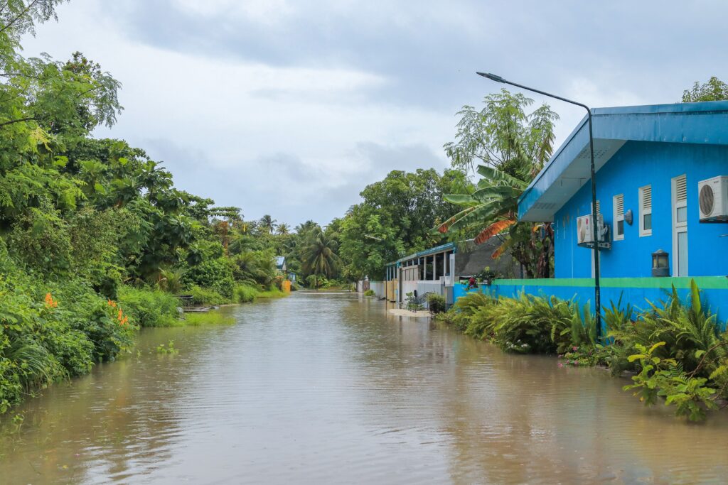
Thailand rain flood warning September 3 — TMD warns of flash floods with isolated heavy rain in 24 provinces across four regions as Tropical Storm Saudel makes landfall in southern China tonight, driving a monsoon trough across Thailand's North, Northeast and Bangkok at 60% coverage with Andaman Sea waves reaching 2 metres.
Quick answer: TMD has issued a September 3 flash flood warning across 24 provinces in four regions. Tropical Storm Saudel is making landfall in southern China tonight — it will NOT enter Thailand, but its monsoon trough is driving heavy rain across the North, Northeast, East, and Bangkok at 60% coverage. Andaman Sea waves up to 2 metres — Phuket, Krabi, Phang Nga mariners stay ashore. Check all routes before driving.
Thailand rain flood warning September 3 is active — the Thai Meteorological Department has warned of isolated heavy rain in 24 provinces across four regions on Thursday September 3, 2026, with accumulated rainfall potentially triggering flash floods and run-off across the North, Northeast, East, and Bangkok areas.
The Thailand rain flood warning September 3 advisory covers the 24-hour period from 6am Thursday to 6am Friday, September 4. A monsoon trough extending across the upper North and upper Laos into Tropical Storm Saudel over the upper South China Sea is bringing unsettled conditions across the region. A moderate southwest monsoon is also prevailing over the Andaman Sea, Thailand, and the Gulf of Thailand — pushing wave heights toward 2 metres in the upper Andaman and making small-boat operations dangerous throughout the September 3 period.
For Indian travelers currently in Thailand — today’s advisory covers every major destination including Bangkok, Chiang Rai, Phuket, Krabi, and the Mekong corridor — this is a planning document, not background noise. See our Thailand flood warning August 20 guide for the full monsoon season context.
Tropical Storm Saudel: What It Is and Why It Matters for Thailand
The Tropical Storm Saudel context is the single most important piece of weather intelligence for anyone in Thailand or traveling to China today.
Tropical Storm Saudel is forecast to make landfall in southern China on Thursday night before weakening into a tropical depression. The storm will not enter Thailand.
This is a critical clarification. Tropical Storm Saudel is not hitting Thailand — but its existence and trajectory is the primary driver of the enhanced monsoon conditions producing today’s heavy rain and flash flood risk. The storm’s monsoon trough — the low-pressure convergence zone that extends westward from the storm’s circulation — is what is delivering the moisture and instability that produces 60% rainfall coverage across Thailand’s North and Northeast.
For Indian travelers heading to southern China — Guangzhou, Guilin, Hong Kong, Shenzhen, or Hainan — the Saudel landfall tonight means checking the weather before departure. Southern China coastal areas and Guangdong Province will be directly affected by Saudel’s wind and rain as the storm makes landfall Thursday night. Travelers already in Guangzhou, Shenzhen, or Hong Kong should monitor local weather authority advisories. Travelers flying into these destinations Thursday or Friday should confirm flight status before departing for the airport.
The Full Regional Forecast: Province by Province
The Thailand rain flood warning September 3 advisory covers six distinct geographic zones with different coverage percentages and specific province-level detail.
North — 60% thunderstorm coverage:
Isolated heavy rain in Chiang Rai, Phayao, Nan, Tak, Uttaradit, Phitsanulok and Phetchabun. Temperatures 22–27°C lows, 31–36°C highs. Southwesterly winds 10–20km/h.
The North at 60% coverage with isolated heavy rain in seven named provinces continues the sustained monsoon pressure that has been affecting the region since the Nan Province flood emergency in mid-August. The same mountain valley geography that caused flash floods in Nan remains at elevated risk. Do not drive mountain roads — Route 108 (Chiang Mai–Mae Sariang–Mae Hong Son) and Route 1095 (Chiang Mai–Pai) — during active rain periods.
Northeast — 60% thunderstorm coverage:
Isolated heavy rain in Bueng Kan, Nakhon Phanom, Mukdahan, Roi Et, Yasothon, Amnat Charoen, Si Sa Ket and Ubon Ratchathani. Temperatures 23–25°C to 32–35°C.
The Northeast’s 60% coverage with heavy rain in the Mekong corridor provinces — Nakhon Phanom, Mukdahan, Amnat Charoen — continues the elevated Mekong River level risk that has been building since the August 10 Nakhon Phanom city flooding. The Mekong has limited capacity to absorb additional rainfall without overflow in the communities along its banks.
Central — 40% thunderstorm coverage:
Main provinces: Nakhon Sawan, Lop Buri, Saraburi, Kanchanaburi and Ratchaburi. Temperatures 23–26°C to 34–36°C.
Central Thailand is at lower intensity today — 40% coverage versus 60% elsewhere — but Kanchanaburi and Ratchaburi on the western border receive moisture from both the Gulf and the Andaman simultaneously, making flash flooding in river valley communities still a genuine risk.
East — 60% thunderstorm coverage, waves 1–2m:
Isolated heavy rain in Nakhon Nayok, Prachin Buri, Chanthaburi and Trat. Temperatures 24–26°C to 33–35°C. Southwesterly winds reaching 15–35km/h. Waves 1–2 metres, exceeding 2 metres during thunderstorms.
The East’s wave data — 1–2 metres baseline, exceeding 2 metres in storms — is directly relevant to Indian travelers on ferry services to Ko Chang (from Trat) and Ko Samet (from Rayong). Check ferry operator status before travelling to piers on September 3–4.
Bangkok — 60% thunderstorm coverage:
Temperatures 25–27°C to 34–35°C. Southwesterly winds 10–25km/h.
Bangkok at 60% coverage means afternoon thunderstorms are highly probable across the capital on September 3. Plan all outdoor Bangkok activities for morning hours — Wat Pho, Grand Palace, Chatuchak, Chinatown, Lumphini Park — and expect significant afternoon downpours. The Chao Phraya Express Boat may modify services during active thunderstorm windows.
South, west coast (Andaman) — 60% coverage, waves up to 2m:
Isolated heavy rain in Phang Nga, Phuket, Krabi, Trang and Satun. Temperatures 23–27°C to 31–34°C. From Phuket northwards: winds 20–35km/h, waves about 2 metres. From Krabi southwards: winds 15–35km/h, waves 1–2 metres. Storm waves could exceed 2 metres throughout.
The Andaman at 60% with 2-metre waves is the most operationally significant weather advisory for Indian travelers. All longtail boat island transfers, speedboat day trips, and open-water activities from Phuket, Krabi, Phang Nga, Ko Lanta, Ko Phi Phi, and Koh Lipe should be confirmed cancelled or postponed under these conditions. Do not accept assurances from operators that the sea “looks fine” — 2-metre wave conditions are officially unsafe for small vessels regardless of localised surface appearance.
South, east coast (Gulf) — 40% coverage:
Thunderstorms mainly in Surat Thani, Nakhon Si Thammarat, Phatthalung, Songkhla, Pattani, Yala and Narathiwat. Waves about 1 metre, increasing 1–2 metres offshore, above 2 metres in storms. Koh Samui, Koh Phangan, and Koh Tao ferry services should be checked before travelling to piers.
| Thailand Rain Flood Warning September 3 — Regional Summary | Coverage | Key Provinces | Sea Conditions |
|---|---|---|---|
| North | 60% | Chiang Rai, Nan, Phitsanulok, Tak | — |
| Northeast | 60% | Nakhon Phanom, Bueng Kan, Ubon Ratchathani | — |
| Central | 40% | Kanchanaburi, Saraburi, Lop Buri | — |
| East | 60% | Chanthaburi, Trat, Nakhon Nayok | 1–2m, >2m in storms |
| Bangkok | 60% | Capital + surrounding | — |
| South west coast (Andaman) | 60% | Phuket, Krabi, Phang Nga, Trang | 2m, >2m in storms |
| South east coast (Gulf) | 40% | Surat Thani, Songkhla, Narathiwat | 1m, >2m offshore |
| Tropical Storm Saudel | Southern China landfall | Does NOT enter Thailand | China coast affected |
What Indian Travelers Must Do Today
In Bangkok: Morning activities only — Wat Pho, Grand Palace, Chatuchak weekend market (if visiting Saturday), Chinatown, Lumphini Park. After 1pm, Bangkok’s 60% coverage makes afternoon thunderstorms highly likely. Have Grab loaded and hotel address saved. Indoor options — ICONSIAM, Terminal 21, One Bangkok, Siam Paragon — are the correct afternoon strategy.
In Chiang Rai or the North: Do not drive mountain roads during active rain. Check road conditions at doh.go.th or Highway Department hotline 1586. The same mountain roads that closed during the Nan emergency are at risk today. Give yourself afternoon flexibility — do not schedule final activities that require mountain road driving after 2pm.
In Phuket, Krabi, or the Andaman: Do not take longtail boats, speedboats, or any small vessels today. Contact your boat operator to confirm cancellation before travelling to the pier. 2-metre Andaman waves with thunderstorm exceedances are unsafe for tourist boat operations. Beach activities are possible in dry morning windows — but the coastline becomes unsafe during active squalls.
Heading to southern China today: Tropical Storm Saudel is making landfall in southern China Thursday night. Check your airline’s flight status if flying into Guangzhou, Shenzhen, Guangxi, or Hainan before departing for the airport. Rain and wind from Saudel will affect southern China through Friday.
TMD hotline: 1182 — call before any outdoor plan. Official weather at tmd.go.th/en. Complete TDAC free at tdac.immigration.go.th before departure. UPI does not work in Thailand — carry Thai Baht. For travel insurance covering Thailand flood disruptions and trip changes, SafetyWing Nomad Insurance provides comprehensive coverage at affordable daily rates for Indian travelers.
FAQs — Thailand Rain Flood Warning September 3
Q: Is Tropical Storm Saudel hitting Thailand?
No — Tropical Storm Saudel is forecast to make landfall in southern China on Thursday night before weakening into a tropical depression. The storm will not enter Thailand. However, its monsoon trough extending across the upper North and upper Laos is the primary driver of the heavy rain and 60% thunderstorm coverage across Thailand’s North, Northeast, and Bangkok on September 3. Travelers heading to southern China should check weather conditions before departure.
Q: Which provinces face the highest flood risk on September 3?
The TMD has warned of isolated heavy rain with flash flood potential in 24 provinces. The highest-risk provinces include Chiang Rai, Nan, Phitsanulok, and Tak in the North; Nakhon Phanom, Bueng Kan, Ubon Ratchathani, and Mukdahan in the Northeast; Chanthaburi and Trat in the East; and Phang Nga, Phuket, Krabi, Trang, and Satun on the Andaman coast. People living near foothills, waterways, and low-lying areas should monitor conditions closely.
Q: Are Phuket and Krabi beaches safe on September 3?
Phuket and Krabi are under 60% thunderstorm coverage with Andaman Sea waves reaching 2 metres and exceeding 2 metres during thunderstorms. Small boats in the upper Andaman Sea should avoid stormy areas. All longtail boat transfers, speedboat excursions, and open-water activities from Phuket, Krabi, Phang Nga, Ko Phi Phi, and surrounding islands should be confirmed cancelled or postponed by operators. Beach access in dry morning windows is possible but conditions can change rapidly. Confirm all water activities with operators before travelling to piers.
Final Word
Thailand rain flood warning September 3 — Tropical Storm Saudel making landfall in southern China tonight but not entering Thailand, 60% coverage in North/Northeast/East/Bangkok/Andaman coast, 2-metre Andaman waves, flash flood risk in 24 provinces across four regions — is a significant monsoon day that Indian travelers in Thailand must plan around.
The morning window before 1pm is workable across most Bangkok and northern destinations. The Andaman coast requires full small-boat suspension. Mountain roads in the North and Nan area require daylight and real-time road status checks before any driving. Saudel’s Chinese landfall tonight means checking China flight status if you are connecting through southern Chinese airports on Thursday or Friday.
Also Read:
- Thailand Flood Warning August 20 — Nan Emergency, 80% North
- Thailand Rain Flood Warning — North Heavy Rain Week of August 16
- Nan Airport Flood 2026 — Open But Allow 3–4 Hours Road Travel
Official Sources:
- Nation Thailand — TMD Warns of Flash Floods With Heavy Rain in Four Regions
- Thai Meteorological Department — tmd.go.th
 Singapore Tourism Receipts 2026: S$7.21 Billion Drop — What It Means for Indians

Bangkok Flooding October 2026: Roads Submerged — What Indians Must Know

Laem Son National Park 2026: Thailand’s Hidden Beach Gem Opens for Tourism Season
Japan Saudi Arabia Travel Alert 2026: Essential Warning for Indians Visiting the Kingdom

Singapore Tourism Receipts 2026: S$7.21 Billion Drop — What It Means for Indians
Bangkok Flooding October 2026: Roads Submerged — What Indians Must Know
Laem Son National Park 2026: Thailand’s Hidden Beach Gem Opens for Tourism Season
Japan Saudi Arabia Travel Alert 2026: Essential Warning for Indians Visiting the Kingdom

Aaseem Bhardwaj is a journalist, seasoned traveler and IT professional based in India. With firsthand travel experience across Southeast Asia, East Asia, Middle East and Europe, Aaseem founded Travel Man Today to provide reliable visa updates and travel news for Indian passport holders. He has personally traveled to Thailand, Vietnam, Malaysia, Japan, Singapore, Hong Kong, South Korea, UAE and Europe. Follow his travel vlogs on YouTube at @travelmantoday






Templates for Indians